

Objectives
To develop and combine the state-of-the-art modelling tools describing the river-ocean continuum in the NEA continental seas, in order to link the eutrophication nuisances in specific marine regions to anthropogenic inputs, and trace back their sources up to the watersheds.
Validated river-ocean models will be used for:
- testing nutrient reduction options at the level of the NEA watersheds;
- producing sea-targeted recommendations for nutrient management on watersheds.
The EMoSEM outcome will be transferred to Member States responsible of the WFD and MSFD in their national domain and to the OSPAR commission.
Concretely the objectives are:
- Suggest innovative ecological indicators to account for HABs in the GES definition.
- Estimate the needs to reach GES in all marine areas (distance-to-target requirement, DTTR).
- Identify “realistic” scenarios of nutrient reduction in the river watersheds of NEA.
- Assess the impact of the “realistic” scenarios in the sea, and compare to DTTR.
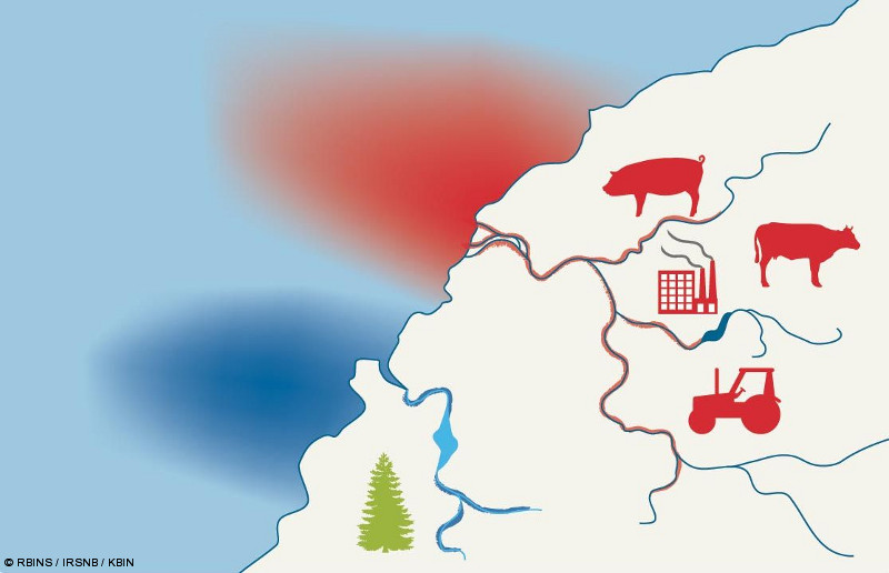
Schematic representation of the project objectives
More specifically, the objectives are:
- to assess the pristine situation in order to propose consistent and harmonized reference ecosystem-based indicators (WP3);
- to assess the current eutrophication status on the basis of existing literature and state-of-the-art marine ecological modelling, with a focus on sub-regional specificities, and on eutrophication consequences upon ecological structures and processes such as phytoplankton dominance, toxic species, trophic efficiency (WP3);
- to estimate in every problematic subregion the specific riverine contributors responsible for the eutrophication nuisances through a transboundary approach (TBNT tracers; Ménesguen et al. 2006) (WP4);
- to evaluate the subregion-specific "distance to target", i.e. the reductions to be undertaken in term of terrestrial nutrient input in the considered marine subregion to achieve the potential success regarding eutrophication GES (WP4);
- to propose realistic scenarios implying efforts at the level of the watersheds in order to reduce anthropogenic nutrient inputs to the rivers and potentially mitigate in the future the eutrophication nuisances at sea (WP5);
- to discuss these realistic scenarios in the perspective of the current eutrophication status, the "distance to target" results, and the natural reference status (as estimated from historical reconstruction, see Lancelot et al. 2009) and to propose achievable nutrient reduction options (WP6);
- to examine whether the present study may contribute to support more accurate or consistent indicators, harmonized metrics and reference levels (WP6);
- to transfer this knowledge to the scientific community (publications, conferences) and to Member States responsible of the WFD and MSFD in their domain and to OSPAR (WP7).
To achieve these objectives the modelling tool development will consist in:
- improving existing ecological models by including specific methods (tracers, distance to target) and validating them against marine and EO data (WP1);
- implementing a new generic river model of the NEA and validating it with actual riverine discharges and nutrient loads (WP2);
- coupling river model and coastal seas models (WP2)
At the end of EMoSEM we hope to deliver coupled river-ocean mathematical models that can help to guide the management choices (Policy- and decision makers) in combating eutrophication problems within the NEA continental waters.
The improved models and the recommendations will be based on innovative and original approaches combining the state-of-the-art modelling tools recently available to address eutrophication-related issues.
References
Lancelot, C., Rousseau, V. and Gypens, N., 2009. Ecologically based indicators for Phaeocystis disturbance in eutrophied Belgian coastal waters (Southern North Sea) based on field observations and ecological modeling. Journal of Sea research, 61: 44-49.
Ménesguen, A., Cugier, P. and Leblond, I., 2006. A new numerical technique for tracking chemical species in a multisource, coastal ecosystem, applied to nitrogen causing Ulva blooms in the Bay of Brest (France). Limnology and Oceanography, 51(1, part 2): 591-601.